January 28th – February
3rd 2013
To start with something nice and
relaxing on Monday, we drove down to the coast (about half an hour).
We were actually going to the Pebble Beach (small beach half way
between Half Moon Bay and Santa Cruz). We stopped at the end of Half
Moon Bay, where is a golf resort and hotel. There is some public
parking and beach access. It was a bit windy and colder, but sunny
and pretty pleasant. We walked around a bit, walked towards the hotel
(there was only few people playing golf), there was outdoor fire pit
(gas) with the flames dancing in the wind. It was nice.


Again, spring is really here!!! (At
least in California.)


We enjoyed the drive, looking around,
made few stops and kept going.

We parked at the Pebble Beach. J. went
down to the beach, I opened the windows in the car and read. She
enjoyed looking and picking shells (and other monkey business). And I
was actually falling asleep. Finally I went down to the beach so we
could move on.


We drove back couple miles and turned
towards Pascadero (historic town). It was one intersection with few
shops, one restaurant and pretty much nothing else. We did not stop,
but turned again towards what looked like more town. There was a
church and some houses. At the end of the town there was a cemetery.
(Nice one.) There J. saw signs pointing to the goat farm.

We followed the sign (and several more)
to the goat farm. There was a driveway and at the end of it was a
fence. Behind were goats. J. (for all her city growing) is somewhat
into “farm stuff”. I guess actually doing it for living would set
her back in reality, but … There was small store, we went in
(obviously) and talked to the lady for about half an hour (mainly
J.). It was interesting, in the attic was big table (24 chairs) for
farm dinners. Really nice.


At that point, it was almost four
o'clock and we wanted to drive across the hills on this small road.
So we did (there was nice park on the hilltops that we wanted to
visit) drive this twisty tiny road. It was really nice, we started
with farm land and wineries, entered the forest and on hilltops saw
incredible views of the country.

We were thinking about going to SF, but
J. was going to work for next 4 days, so we went to the open space
preserve instead. Nice relaxing nature. The drive was somewhat longer
(and surprisingly twisty), it was about 7 miles of 280 freeway in
Palo Alto. But it was nice, there were some views of the bay along
the bay and at the end, there was nice parking lot.


When I was pulling in J. told me there
is funny bumper sticker on the only other car there. We got out and
looked and it was more then hilarious.

After we stopped laughing, we checked
the map and started walking. There was a small detour and from that
point, we had some incredible views of the bay and the city. It was
nice and sunny day, so we could probably see as far as possible.

We picked few interconnected trails and
made pretty nice circle (about 3.5 miles). There was even small trail
describing effects of the earthquake. It was pretty interesting. We
were apparently walking on the top of the fault. We met two older
ladies from the funny car and one of them had children who went to
University of Michigan (there was the reason for the sticker). It was
not really steep area, so it was pretty nice and pleasant walk.


We drove home via Skyline boulevard. It
was longer and took more time, but it was really nice day and we
enjoyed nice forest, exquisite views and sunshine.


The rest of the week J. had to work. On
Friday I took the train to San Francisco, waited forever for the
light rail to the Ocean Beach. It took about 45 minutes to cross the
city. It was somewhat interesting, there was not too many people on
the train, but all the stopping made me kind of sick. Though I still
enjoyed the ride. I rode the train to the last station, got off the
train, cross the road and was standing on the beach. It was pretty
cool.


My plan was to walk along the coast to
the Golden Gate bridge and then back to the city. It looked pretty
nice and possible (maybe 7-8 miles). This way I was as well going to
see how hard or easy it will be to drive around (looked pretty easy,
plenty of parking). Pretty soon I got to the area, where used to be
some bath houses or spas. There were some left over ruins next to the
ocean.


Shortly after that I finally started to
see Golden Gate Bridge.

There was the trail going all the way
from SF Zoo to the Golden Gate, from there you could continue on the
promenade. It was pretty, for the most of the time I saw the ocean,
later I had the bridge in front of me. There was few residential
streets that I had to walk through. There were actual lawns and the
front yards. Many of those houses had ocean views. I later looked
online and those houses are going for at least 4 millions dollars.


There was as well this funny trail sign
(would be interesting to walk to Mexico).

As I said, for most of the walk I could
see the bridge, so I have many pictures. There was few steep parts of
the road, but otherwise it was pretty nice. I took couple of detours
(not planned), got a bit lost between the houses, but nothing too
bad. I was hoping that I could walk along the beach and underneath
the bridge, but it did not look god, so I did not try. I started to
walk at ten o'clock so by noon it was getting pretty warm. Probably
by that time, I got to the bridge. There was a trail along the old
batteries and under the bridge. There was more people, but it was
still fine.


I dropped down to the Golden Gate
Bridge promenade and walked towards the city. Unfortunately there was
many more people (still probably not as bad as weekend) and it was
slightly less enjoyable. Again, the views of the bay, now Alcatraz
and the city were really amazing.

I was still fine so I have decided just
to walk to the train station. I figured I would cross the city. So I
left the ocean and started to walk up. Up. Up. It was steep street.
But there were people, shops and restaurants and it felt like real
city (Europe). San Mateo has two streets as a downtown district with
bunch of shops and restaurants, but it does not feel like real city.
The same was for Sunnyvale. There is a street or two with “downtown”,
but it is kind of strange. San Francisco has many “real areas of
the city”. It is hard to describe. But I did really enjoy it (even
I was walking up).

The views down the street were great.
Looking down and enjoying it. It took a while to get on the top of
the hill. I left the shopping area behind me and walked through the
residential part.

It was nice to be finally down with
going up. I was going to pass through Japan town. When I got there,
it was somewhat disappointing. There were some stores and bunch of
flags on the street lights, but it looked kind of deserted and
strange. I found small square with interesting structure and
extensive shopping in two big buildings (I did not go in, I left it
for another day with J.).

At that time, I started to have enough
and just followed the shortest way to the train station. I walked
through Little Saigon (many homeless people), a bit messy and run
down. I got on the Market street and was surprised, it looked really
bad. Few boarded up buildings, many homeless people, mess and lack of
people. It felt a bit scary. I walked there three blocks to get on
Fifth street and I could see how pass that point there was so many
people. That was the tourist area, I was apparently somewhere else.
Well, I guess that happens. I got on the train and left for home. It
was really nice trip. After I ate and took shower (and did pretty
much nothing for the rest of the day), I discovered that I walked
about 14.5 miles. Good for me.

On Sunday, I dropped J. off at work and
drove up Page Mill road (the same place as Los Trancos Preserve).
Across the road, there was Monte Bello Preserve. It was still dark
and I drove up that funny twisty road. When I got there, parking lots
were still locked (7 am), so I had to park along the road. It was
cold. I was going to follow the trail described in the book of hikes
in Bay area. It was a bit foggy in the distance, otherwise just nice,
quiet and really peaceful.


I was not really going to take
pictures, but when I got a bit further from the road, it started to
look really interesting. The fog was creating some great images and I
was surprised by those magical looks. For over two miles I walked
downhill. The aim was a mountain top – Black mountain. I was
walking along side rolling hills, the gray sky still playing with the
fog could not decide about the fate of the day. I could see a small
house on the edge of Skyline Boulevard. There has to be something
really special about living on the top of the canyon. There were
lonely trees on many small hill tops and they were quietly singing in
the slowly moving fog. It was still cold and even the lizard could
not really move. I almost stepped on him, then took a picture and he
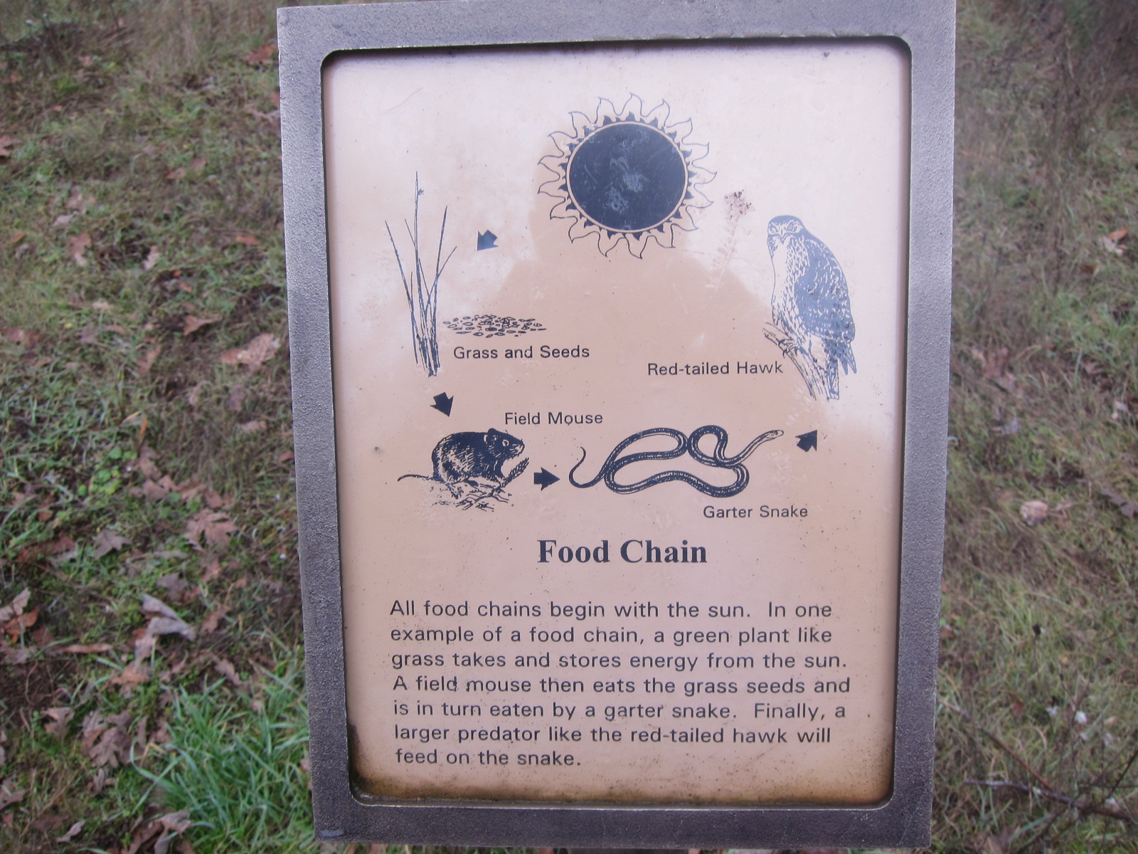
really did not want to move. A minute later, I found a picture of
“food chain in nature”. As much as a human enjoys the nature's
setting (like this one) and cares about the balance, at a moment he
is able to bring a bulldozer and ….

I crossed couple of trails and the
Indian trail was the one leading to the mountain top. It was more
like a fire road. Steep one. I had a jacket off and still I was
sweating and running out of breath. I was still surrounded by rolling
fog. I can imagine the views during the day are pretty, but those
images of fog covering most of the landscape and moving around were
beyond imaginable.


Almost on the top, there was an area
for backpack camping. And actually, there was one tent. The foggy
images changed at this point. I started to see sun and some blue sky.
It was somewhat strange. How all that was blending together. I had
less then 0.3 miles to get to the top (there was communication tower,
more like big yard with bunch of thingies around, fenced). It was
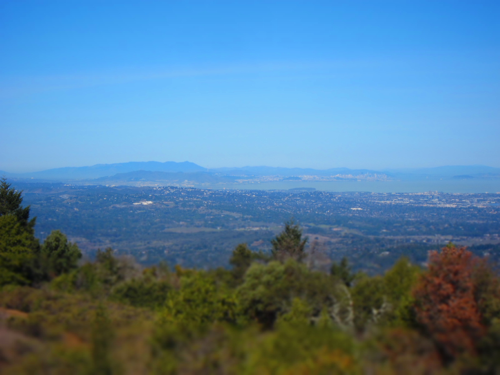
actually sunny with blue sky on the top of the mountain (2812 feet).
Going up I passed guy going down. There was couple people on bicycles
and another couple walking. It was like a public square. But the
views of the valley completely filled with fluffy white fog were
beyond amazing and beyond description.


I took different trails back to the
parking area. From there I could see that the valley is actually
pretty small. On the trail below me I even saw a mountain lion. And
above me, at one point, I saw about 8 deers just looking at me. After
enjoying full sun on the top, I got lost in the fog again (and met
few more people).


And I was back at the parking lot.
There was 5 cars. It was incredible walk. I walked across the road
and up the hill so I could see the city (that was Los Trancos). There
was few clouds, but I could still see the city. Drive down and home.
There was so many people on bicycles (going up luckily) on the road.


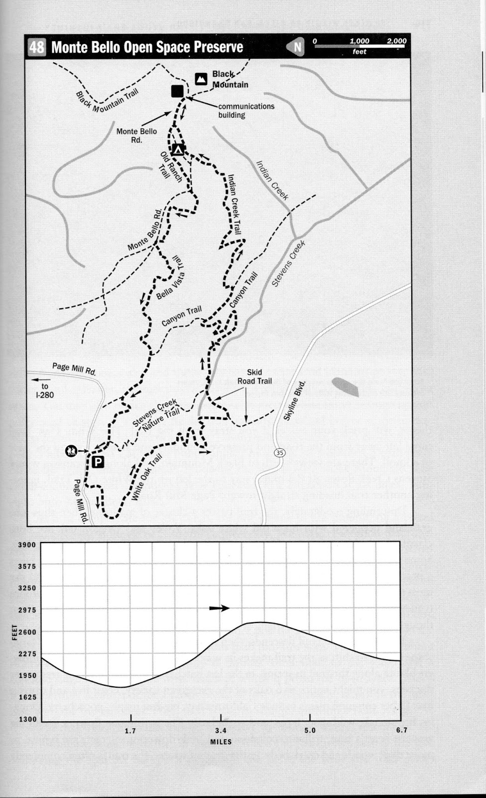
This is the description of the walk I
took from the hiking book.