Monday March 3rd 2012
Nice day. Breezy and sunny. Could not
agree what to do, picked up Almaden Quicksilver County Park on the
south side of San Jose. The drive was fine. Some freeway, left city
and got into small town. Used to be quicksilver (mercury) mining area
till 1970's. Horses and farms. Less and less traffic. We parked. We
followed historic trail. Nice and green area. Many hills around. Few
houses on those hills (crazy people, probably rich too). On the
bottom, the collection of equipment from the mining (behind fence).
Walking. It was uphill, J. did not like it. Not much stuff left from
the mining era (interesting).


Less than 1.5 miles of walk, English
Camp. One of the historic sites from the mining era. We read the
booklet and as well the information boards along the way. People used
to live here. Church. School. Store. Only few falling buildings left.
During 1930's site of CCC. English Camp was almost the top of the
walk. After cloudy morning, it got mostly sunny. Really quiet and
peaceful. Some views of the valley. Continuing. Spanish Camp. One of
the tunnels (pretty much nothing left). More views. Two tall hills
(with funny names), later discovered that not open to public. Mostly
private land all the way around. The rotary furnace (or something
like that) left on the side of the hill. Hanging tree (used for
justice). Really small tree though. Continuing. J. had enough. We
passed through the top, from there mostly downhill.
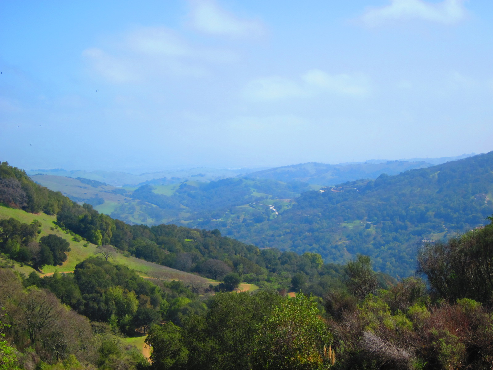

Pretty nice. J. had more than enough
(not many choices to make it shorter). The views of west (the area
without cities) were incredible. How much the area can change in
relatively short time. The comparison of pictures and the reality in
front of us. Unbelievable. We started our downhill walk. Small detour
to San Cristobal mine. Small clearing, picnic area and a small tunnel
going into the hill. Small train track on the ground. We could walk
probably 6 feet into the real mountain (the rest of the tunnel was
outside structure. It was still cool. Significant temperature change.
Unfortunately, there was heavy duty welded together gate to stop us.
We tried to see in the darkness, but did not see much. Great.
Continuing. J. skipped April's trail (I walked it alone), about 0.6
miles. There was reconstructed Powder house and loading “dock”
area (ruins). Really nice. Back on the trail. Continuing.


About 1.3 miles left (downhill). Nice
views. Nice weather. Pretty warm. Met some people walking. Few
additional historical sites. There was supposed to be a chimney. Did
not see it. Steep hill. It used to be a site of a tram to carry the
rock from the hills down to the furnace. Nothing left but sign. There
was even a picture of the track. Again, unbelievable. Quiet parking
lot. Left. Very similar drive to the city. J. thought of barbeque
restaurant for me along the way (San Jose). Found on the phone map,
stopped and eat there (pretty good). We passed very different
neighborhoods (some very similar to 8th mile in Detroit).
One rose garden visible from the road. Nothing blooming. Did not
stop. Pretty easy drive.

Continuing. There was supposed to be
another Heritage Rose garden. Found. Stopped. Next to freeways and
actually downtown San Jose as well. We walked around a bit. It will
be pretty when the roses are blooming, but not now. Still, kind of
interesting. We checked the map. Decided to drive through downtown
San Jose. Less then two minutes and row of green lights. J. did not
believe we drove through downtown. Turned around, drove another
street and than back again. Really, very strange downtown. Again,
many homeless people. Not much traffic. Got on 280 freeway and drove
home. Stopped along the way at Grocery Outlet (good prices, limited
selection). We were craving ice cream. Home. J. got some blisters.
Talking about next day and possibly doing City Pass for San
Francisco. No decision.
